Showing posts with label earth changes. Show all posts

November 30, 2010

More Indonesian volcanoes getting restless

"Our Amazing Planet"
2010-11-29 15:31:00


As if things weren't already bad enough in Indonesia, another volcano may be about to blow.

Indonesia straddles the Pacific Ring of Fire - and lately, this nation of islands has been living up to the region's fiery reputation. A number of so-called minor ash explosions from Mount Bromo on Sunday (Nov. 28) caused a nearby airport to close as scientists upgraded the volcano to its highest alert level, according to the Indian newspaper The Hindu. On the same island, Java, Mount Merapi's recent eruptions killed hundreds and prompted mass evacuations.

The eruption watch also continues in the straight just west of Java where Anak Krakatau has also been increasingly active lately.

Still want to visit Indonesia? Try virtual tourism.

The heightened eruption alerts come just a couple weeks after Mount Merapi's relentless erupting killed more than 300 people.

Mount Merapi's devastation has been estimated at $611 million and pyroclastic flows have destroyed huge swaths of forest (and one unfortunately placed golf course), according to the People's Daily Online."

November 29, 2010

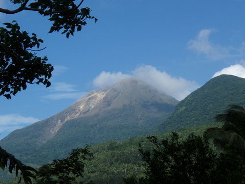
Bulusan explodes

Rey M. Nasol
Inquirer.net
2010-11-27 13:56:00


Rey M. Nasol
Inquirer.net
2010-11-27 13:56:00

16100701.jpg

Legazpi City -- An "explosion-type" earthquake was recorded by the Philippine Institute of Volcanology and Seismology in in Sorsogon Friday night.

In its latest bulletin, Phivolcs said that the quake occurred at around 7:27 p.m. and lasted for about 11 minutes. Clouds, however, prevented state volcanologists to visually observe it.

The statement did not say what distinguished an "explosion-type" earthquake from any other volcanic tremor.

Sulfur dioxide emission rate was measured at 13 tons per day.

About 11 volcanic quakes were also recorded by the seismic network around the volcano during the past 24-hour observation period.

Phivolcs said Bulusan's status remained at alert level 1 and the public was reminded not to venture into the four-kilometer permanent danger zone as sudden steam and ash explosions may occur.


Legazpi City -- An 'explosion-type' earthquake was recorded by the Philippine Institute of Volcanology and Seismology in in Sorsogon Friday night.

In its latest bulletin, Phivolcs said that the quake occurred at around 7:27 p.m. and lasted for about 11 minutes. Clouds, however, prevented state volcanologists to visually observe it.

The statement did not say what distinguished an 'explosion-type' earthquake from any other volcanic tremor.

Sulfur dioxide emission rate was measured at 13 tons per day.

About 11 volcanic quakes were also recorded by the seismic network around the volcano during the past 24-hour observation period.

Phivolcs said Bulusan's status remained at alert level 1 and the public was reminded not to venture into the four-kilometer permanent danger zone as sudden steam and ash explosions may occur."

November 15, 2010

Jakarta. In the wake of recent calamities such as the Mount Merapi eruptions and Mentawai tsunami, the government is considering including disaster preparedness in school curriculums nationwide.


October 26, 2010

Watch the Ring of Fire! Merapi is erupting

Indonesia's Mount Merapi has begun to erupt, spewing searing clouds of volcanic ash and rocks into the sky, killing three people.

One of those who died on Tuesday was a baby who suffered breathing problems, while another 30 people have been injured.

Surono, the government's chief volcanologist, said the mountain, which had been rumbling for hours, started to erupt just before dusk, a day after the agency raised the alert status to the highest level.

"We heard three explosions around 06:00 pm (1100GMT) spewing volcanic materials as high as 1.5 km upward and heatclouds down on the slopes," Surono, who like many Indonesians goes by only one name, told the AFP news agency.

Indonesian scientists had warned of a pressure build-up beneath Mount Merapi's lava dome, as authorities evacuated tens of thousands of villagers to temporary shelters.
Rock avalanche

An avalanche of rocks spilled down Merapi's slopes before dawn on Tuesday and gusts of ash rose 50 metres into the air as the mountain continued to rumble.

Surono had said earlier that the greatest concern was pressure building behind a massive lava dome that has formed near the tip of the crater.

"The energy is building up. ... We hope it will release slowly," he said.

"Otherwise, we're looking at a potentially huge eruption, bigger than anything we've seen in years."

Temporary shelters were set up after officials designated an area 10km around the country's most active volcano a danger zone.

More than 50,000 people living in the shadows of the volcano, located north of the Javanese cultural capital, Jogjakarta, are now facing evacuation.

Widi Sutikno, a field co-ordinator in the Sleman district on the southern slopes of the 2,914-metre mountain, said about 3,700 people had already moved to makeshift camps.

"We have evacuated many women, pregnant women, sick people, elderly people and children," Sutikno said.

"We let some people return to their fields for their daily activity. But they need to go back to the camps and not their houses."
Huge panic

Step Vassen, Al Jazeera's correspondent close to Mount Merapi, said: "There was huge panic of course when the eruption was taking place.

"Two women are in hospital with severe wounds due to the hot gas clouds that came down from the mountain that can reach 600 degrees Celsius, so they are very dangerous.

"Now thousands of people are running away, they are trying to find a safer place. They are going to the refugee centres that have been set up by the government."

Vassen said that as Merapi is the most active volcano in the country residents were reluctant to leave for fear of leaving homes and livestock unattended for a false alarm.

Merapi last erupted in 2006, when it sent an avalanche of pyroclastic ash - hot gases and rock fragments - racing down the mountain which killed two people.

A similar eruption in 1994 killed 60 people, while 1,300 people died in an eruption in 1930.

There are more than 129 active volcanoes in Indonesia, which are spread across 17,500 islands and prone to eruptions and earthquakes due to its location within the so-called Ring of Fire.

The ring comprises a series of fault lines stretching from the western Hemisphere through Japan and Southeast Asia.

March 09, 2008

Magnetic Field of Earth

Earth’s Inconstant
Magnetic Field

Our planet’s magnetic field is in a constant state of change, say researchers who are beginning to understand how it behaves and why.


Link to story audioListen to this story via streaming audio, a downloadable file, or get help.

see captionDecember 29, 2003: Every few years, scientist Larry Newitt of the Geological Survey of Canada goes hunting. He grabs his gloves, parka, a fancy compass, hops on a plane and flies out over the Canadian arctic. Not much stirs among the scattered islands and sea ice, but Newitt’s prey is there–always moving, shifting, elusive.

His quarry is Earth’s north magnetic pole.

At the moment it’s located in northern Canada, about 600 km from the nearest town: Resolute Bay, population 300, where a popular T-shirt reads “Resolute Bay isn’t the end of the world, but you can see it from here.” Newitt stops there for snacks and supplies–and refuge when the weather gets bad. “Which is often,” he says.

Right: The movement of Earth’s north magnetic pole across the Canadian arctic, 1831–2001. Credit: Geological Survey of Canada. [more]

Scientists have long known that the magnetic pole moves. James Ross located the pole for the first time in 1831 after an exhausting arctic journey during which his ship got stuck in the ice for four years. No one returned until the next century. In 1904, Roald Amundsen found the pole again and discovered that it had moved–at least 50 km since the days of Ross.


Sign up for EXPRESS SCIENCE NEWS delivery

The pole kept going during the 20th century, north at an average speed of 10 km per year, lately accelerating “to 40 km per year,” says Newitt. At this rate it will exit North America and reach Siberia in a few decades.

Keeping track of the north magnetic pole is Newitt’s job. “We usually go out and check its location once every few years,” he says. “We’ll have to make more trips now that it is moving so quickly.”

Earth’s magnetic field is changing in other ways, too: Compass needles in Africa, for instance, are drifting about 1 degree per decade. And globally the magnetic field has weakened 10% since the 19th century. When this was mentioned by researchers at a recent meeting of the American Geophysical Union, many newspapers carried the story. A typical headline: “Is Earth’s magnetic field collapsing?”

Probably not. As remarkable as these changes sound, “they’re mild compared to what Earth’s magnetic field has done in the past,” says University of California professor Gary Glatzmaier.

see captionSometimes the field completely flips. The north and the south poles swap places. Such reversals, recorded in the magnetism of ancient rocks, are unpredictable. They come at irregular intervals averaging about 300,000 years; the last one was 780,000 years ago. Are we overdue for another? No one knows.

Left: Magnetic stripes around mid-ocean ridges reveal the history of Earth’s magnetic field for millions of years. The study of Earth’s past magnetism is called paleomagnetism. Image credit: USGS. [more]

According to Glatzmaier, the ongoing 10% decline doesn’t mean that a reversal is imminent. “The field is increasing or decreasing all the time,” he says. “We know this from studies of the paleomagnetic record.” Earth’s present-day magnetic field is, in fact, much stronger than normal. The dipole moment, a measure of the intensity of the magnetic field, is now 8 × 10²² amps × m2. That’s twice the million-year average of 4× 10²² amps × m2.

To understand what’s happening, says Glatzmaier, we have to take a trip … to the center of the Earth where the magnetic field is produced.

At the heart of our planet lies a solid iron ball, about as hot as the surface of the sun. Researchers call it “the inner core.” It’s really a world within a world. The inner core is 70% as wide as the moon. It spins at its own rate, as much as 0.2° of longitude per year faster than the Earth above it, and it has its own ocean: a very deep layer of liquid iron known as “the outer core.”

see captionRight: a schematic diagram of Earth’s interior. The outer core is the source of the geomagnetic field.

Earth’s magnetic field comes from this ocean of iron, which is an electrically conducting fluid in constant motion. Sitting atop the hot inner core, the liquid outer core seethes and roils like water in a pan on a hot stove. The outer core also has “hurricanes”–whirlpools powered by the Coriolis forces of Earth’s rotation. These complex motions generate our planet’s magnetism through a process called the dynamo effect.

Using the equations of magnetohydrodynamics, a branch of physics dealing with conducting fluids and magnetic fields, Glatzmaier and colleague Paul Roberts have created a supercomputer model of Earth’s interior. Their software heats the inner core, stirs the metallic ocean above it, then calculates the resulting magnetic field. They run their code for hundreds of thousands of simulated years and watch what happens.

What they see mimics the real Earth: The magnetic field waxes and wanes, poles drift and, occasionally, flip. Change is normal, they’ve learned. And no wonder. The source of the field, the outer core, is itself seething, swirling, turbulent. “It’s chaotic down there,” notes Glatzmaier. The changes we detect on our planet’s surface are a sign of that inner chaos.

They’ve also learned what happens during a magnetic flip. Reversals take a few thousand years to complete, and during that time–contrary to popular belief–the magnetic field does not vanish. “It just gets more complicated,” says Glatzmaier. Magnetic lines of force near Earth’s surface become twisted and tangled, and magnetic poles pop up in unaccustomed places. A south magnetic pole might emerge over Africa, for instance, or a north pole over Tahiti. Weird. But it’s still a planetary magnetic field, and it still protects us from space radiation and solar storms.

see caption

Above: Supercomputer models of Earth’s magnetic field. On the left is a normal dipolar magnetic field, typical of the long years between polarity reversals. On the right is the sort of complicated magnetic field Earth has during the upheaval of a reversal. [more]

And, as a bonus, Tahiti could be a great place to see the Northern Lights. In such a time, Larry Newitt’s job would be different. Instead of shivering in Resolute Bay, he could enjoy the warm South Pacific, hopping from island to island, hunting for magnetic poles while auroras danced overhead.

Sometimes, maybe, a little change can be a good thing.

Source: Nasa Website

Published in: on March 8, 2008 at 4:11 pm

The URI to TrackBack this entry is: http://rashidfaridi.wordpress.com/2008/03/08/magnetic-field-of-earth/trackback/

see also:

http://www.michaelmandeville.com/earthmonitor/polarmotion/2006_wobble_anomaly.htm

Threads Tagged With: wobble, or Similar

(chandler wobble) Chandler Wobble
(chandler wobble) Chandler wobble and position of north pole ?
(earths wobble) Earth Unwobbling
(chandlers wobble) Major Anomaly In Chandler's Wobble.. Could Be The Start Of A Pole Shift.
(earth wobble) Wobbly Planet Triggered Massive Methane Burps
(wobble) The Wobble Is Real !!!
(wobble) Over FIFTY earthquakes in the last several hours in Alaska and still counting

http://www.huttoncommentaries.com/article.php?category=4&article=75
For a refutation of Michael Mandeville


October 17, 2007

Latest on Mount Merapi (you can search the blog via the search box for previous items on this. Please pay attention to Maridjan's input on all this. I have taken great pains to ensure that whatever he says gets published on line, as the MSM media tries to bury whatever he says.)

Security


Jakarta, 17 Oct. (AKI) - One of Indonesia's deadliest volcanoes, Mount Kelud could explode at any minute. But not all of the 24,000 people living in its shadow are willing to abandon their homes and properties, local media report.

In statement posted to its website, the Volcanology and Geological Disaster Mitigation Centre (PVMBG) said the volcano's explosion is "imminent".

The authorities have ordered a compulsory evacuation for the inhabitants of the area, yet reports say that some villagers have decided to defy the wrath of the volcano and stay to feed the livestock, look after the crops and protect their houses.

Tempting fate is not unusual among some Indonesians, who often trust centuries-old mystical traditions more than modern science.

Last year, as Central Java’s Mount Merapi - another active volcano - was believed to be about to erupt - residents stayed put and listened to Maridjan, a seventy-something year old local, who said that nothing would happen.

Maridjan is Mount Merapi's 'gatekeeper' and he is believed to be the medium between the residents and the mountain spirits

Mount Kelud does not seem to have a 'gatekeeper.’ What it has, instead, is a fierce reputation as one of the most dangerous among Indonesia’s 70 active volcanoes.

The 1,731-meter volcano last erupted in 1990, destroying one hundred villages and killing 5,160 people. Experts believe another eruption is already overdue.

Indonesia's 17,000 islands lie on the so-called ‘Pacific Ring of Fire,’ a series of volcanoes and fault lines stretching from the Western Hemisphere through Japan and Southeast Asia.

Scientists say sthat 90 percent of all the world's earthquakes and 81 percent of the world's largest earthquakes occur along this line.

Indonesia has had two of the world's biggest volcanic eruptions in the past 200 years: Mount Tambora in 1815 which killed over 71,000 people; and Krakatau in the Sunda Straits in 1883 which killed an estimate of 36,400 people.

April 22, 2007

Let's revist Mt. Merapi

However, let me be clear that I dont' think there are any Easy Answers to any earthchanges!!


Earthquakes lead to increased volcanic activity
Malaysia Sun
Wednesday 11th April, 2007
(ANI)
http://story. malaysiasun. com/index. php/ct/9/ cid/89d96798a395 64bd/id/240773/ cs/1/
(okay. I did try to fix the link, I really did!!)

Washington, Apr 11 : Scientists using NASA satellite data have found strong evidence that a major earthquake can lead to a nearly immediate increase in regional volcanic activity.

The intensity of two ongoing volcanic eruptions on Indonesia's Java Island increased sharply three days following a powerful, 6.4-magnitude earthquake on the island in May 2006. The increased volcanic activity further persisted for about nine days.

"During this period, we found clear evidence that the earthquake caused both volcanoes to release greater amounts of heat, and lava emission surged to two to three times higher than prior to the tremor," said lead author of the study, Andrew Harris, from the University of Hawaii, Honolulu.

While scientists have long debated whether earthquakes can trigger new volcanic eruptions, this study linked an earthquake to enhanced volcanic activity at two ongoing eruptions that were being closely monitored by satellite-based sensors on a daily basis.

At the time of the earthquake, each volcano was being checked for changes in heat output by satellite sensors as part of a routine global "hot spot" monitoring effort that uses near real-time satellite data from NASA's Terra and Aqua satellites.

Maps of worldwide hot spot activity are created with data from the Moderate Resolution Imaging Spectroradiometer (MODIS) instrument on these satellites, pinpointing locations where surface temperatures are much hotter than their surroundings.

Researchers combined these data with other details about the Indonesian volcanoes gathered by the satellites to analyze temperature and lava output rates at both volcanoes over a 35-day period spanning the earthquake.

They found that the two volcanoes, Merapi and Semeru, which are about 260 kilometres apart and roughly 50 kilometres north and 280 kilometres east of the earthquake epicentre, showed an increase in eruption rate due to underground stresses from the earthquake's seismic waves.

The seismic waves pumped magma -- molten rock beneath the surface -- into the conduit to the surface, increasing eruption rates.

"The responses at Merapi and Semeru lagged about three days behind the triggering earthquake, which may reflect the time it took the change felt by magma residing at deeper levels to be transmitted to the surface," said Harris.

The researchers said that regional earthquake events had sufficient power to modify the intensity of activity at ongoing eruptions, although they may not always be able to trigger new volcanic eruptions.

According to their findings, the Java earthquake had a significant influence on the volcanoes for a relatively short period of several days.

"Eruptions must be closely and continuously monitored in the days immediately before, during and after an earthquake if we are to link any earthquake with enhanced volcanic activity," added Harris.

The research was recently published in the American Geophysical Union's Geophysical Research Letters.

ShareThis